
GoPro / Dashcam Video
Capture high-resolution, geo-located video for GIS-based pavement and asset inspections.
Road Asset Inventory & Management System
AI-assisted platform for pavement and asset survey, monitoring and assessment.
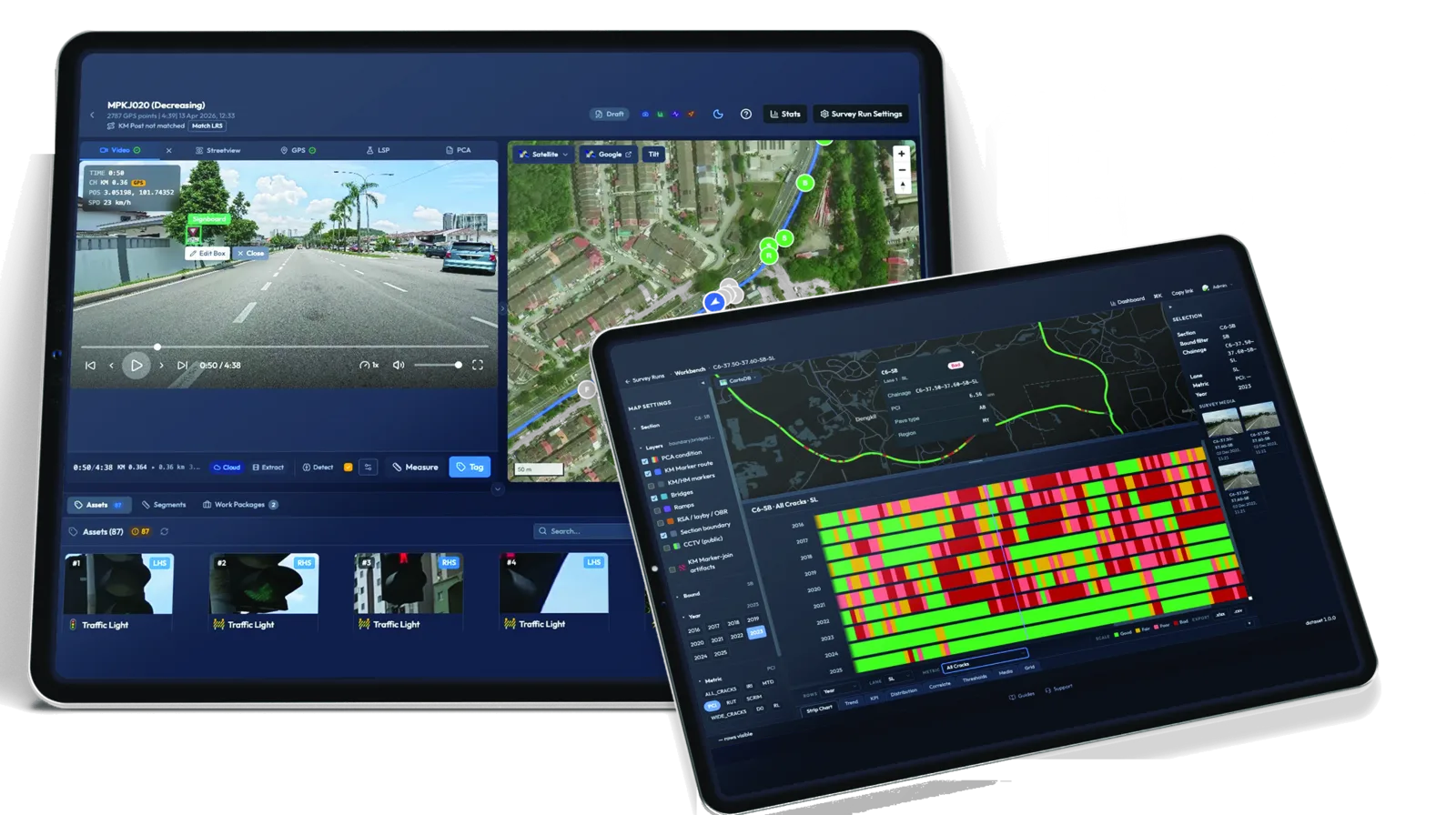
AI-assisted road intelligence platform
RAIMS brings road surveys, asset inventory, condition assessment and PCA intelligence together, so survey footage becomes data you can act on.
Capture high-resolution, geo-located video for GIS-based pavement and asset inspections.
AI automatically detects, tags and assesses road assets and pavement distresses, including potholes and cracks.
Analyse pavement indicators such as IRI, rutting, cracks, surface texture and PCI for better decision making.
Generate fully compatible reports with JKR & LLM outputs. Customisable on request.
How it works
Five steps from the survey vehicle to a TEAMS-ready report.
Drive the route with a GoPro or dashcam mounted on the survey vehicle, capturing geo-located video of the road and its assets.
Upload the footage. RAIMS aligns GPS points to KM posts and chainage, and splits the run into road segments.
AI detects and tags road assets such as signs and traffic lights, and assesses asset condition and pavement distresses.
Verify results against the footage, then analyse IRI, rutting, cracking and PCI in the Workbench with an audit trail on every edit.
Generate reports compatible with JKR TEAMS / TRAMS for maintenance planning and submission.
Platform modules
Each module picks up where the last one ends: tag the assets, assess their condition, review the corridor and analyse the pavement.
01
Automatically detect, classify and map road assets from survey footage. Generate structured inventories rapidly with AI-assisted tagging, map-based review and scalable project setup.
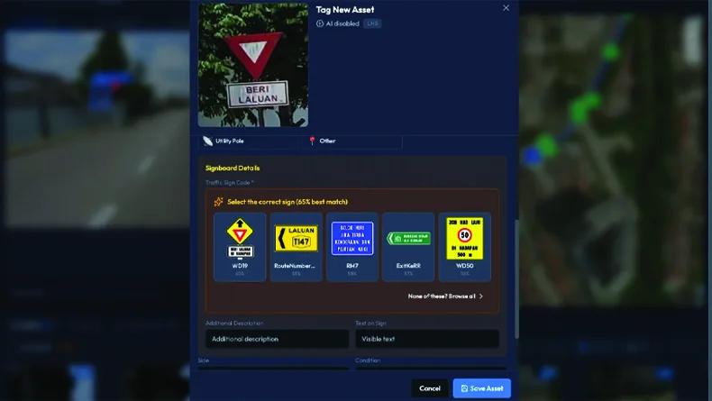
02
Detect, assess and report road-asset, road condition and surface distresses using advanced AI. Generate severity summaries and structured reports for maintenance planning.
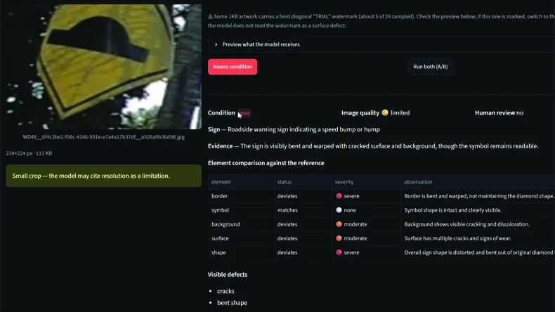
03
Transform forward-facing GoPro survey video into high-resolution orthophoto views for inspection and corridor review. Combine video, streetview and mapped context for clearer visual understanding.
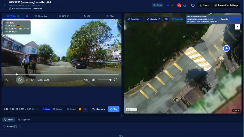
04
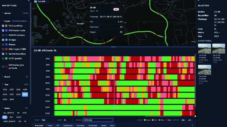
Review pavement condition data using strip charts, map-linked analytics and segment comparison. Analyse IRI, rutting, MTD, all cracks and PCI to support prioritisation and reporting.
Why RAIMS?
AI takes on the repetitive tagging and assessment, so your team spends its time on review and decisions.
Centralised road information
Improved chainage accuracy
Up to 90% less manual work, with 91% AI accuracy
Faster delivery of results
Gallery
Screens from the platform in the order the work happens, from recording a survey run to QA before submission to TEAMS.
Partner with us to build a smarter, AI-assisted road asset network now.